U.S. CONCENTRATION CAMPS
WAKE UP!!!
Here are some photo's and information with regards to the concentration camp program established in the US under the Rex 84 program. Rex 84 was established on the reasoning that if a mass exodus of illegal aliens crossed the Mexican/US border, they would be quickly rounded up and detained in detention centres by F.E.M.A. Rex 84 allowed many military bases to be closed down and to be turned into prisons. These prisons are located all across the USA. Therefore it is unreasonable to assume that the mass exodus of illegal aliens was the true intention.
Operation Cable Splicer and Garden Plot are the two sub programs which will be implemented once the Rex 84 program is initiated for its proper purpose. Garden Plot is the program to control the population. Cable Splicer is the program for an orderly takeover of the state and local governments by the federal government. F.E.M.A. is the executive arm of the coming police state and thus will head up all operations. The Presidential Executive Orders already listed on the Federal Register also are part of the legal framework for this operation.
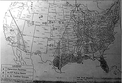
A U.S map which details the locations of detention centers, MJTF Police Bases and U.N. Combat Groups. The Picture of this map came from, "70th Week Magazine" P.O. Box 771, Gladwater, Tx. 75647. This is a 1994 photo.
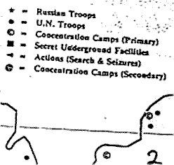
This is a blow up of the legend of the map below.
a. A dark star symbol=Russian Troops
b. A dark circle dot=U.N. Troops
c. A circle with a "c" in it=CONCENTRATION CAMPS (Primary)
d. A square dark symbol=Secret Underground Facilities
e. A dark triangular shaped symbol=Actions (Search and Seizures)
f. The @ symbol=CONCENTRATION CAMPS (Secondary)
DETENTION FACILITIES: Are stars, with a white center.
MJTF POLICE BASES: are white stars in a round black circle.
U.N. COMBAT GROUPS: are marked on the map with airplane's.
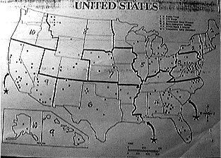
This is another U.S. map, that contains the markings, for the different camps.
This shows the North Eastern section of the U.S., and shows a closer look, where U.N. troops are located in North Western Montana, and a few other states as well.
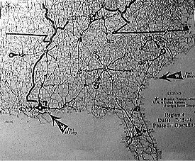
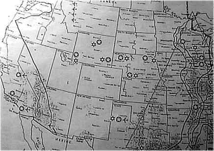
This is a view of the South Eastern U.S. on a map. The map is named, Region 4, 15 August 1994, "Phase III Operation". The legend shows a black star symbol, where Russian troops/Armor are. U.N. symbol, for United Nations (foreign battle groups). The map also has markings for "Ports of Entrys" into the U.S., by sea.
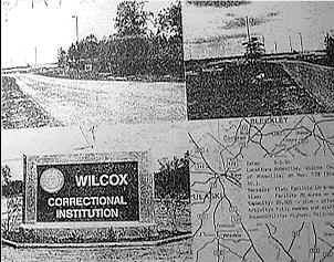
This is a photo copy view, of the Wilcox Correctional Institution. It also has exact details on location, and other information about the camp.
Another view of Wilcox Correctional Institution.
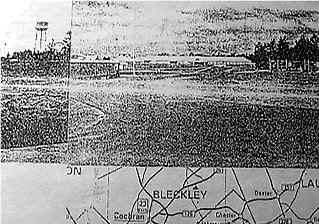
Here is a photo blowup, of the directions of where Wilcox is, as well as other important information of the institution.
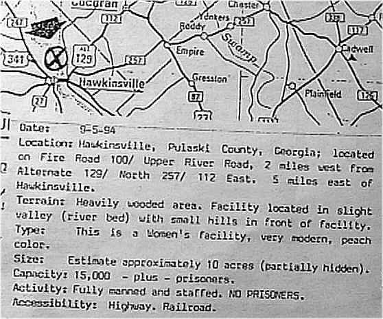
There are over 100 primary and secondary concentration camps across the US. Each houses about 20,000 prisoners. Currently the largest of these facilities is the just outside of Fairbanks, Alaska. The Alaskan facility is a gigantic mental health facility and can hold approximately 2 million people. The majority of these facilities have no prisoners but are currently staffed by military personal. The camps all have have railroad facilities, as well as roads, coming and going out of them, to get there. Also quite a few are closed down military bases and are adjacent to airport facilities.