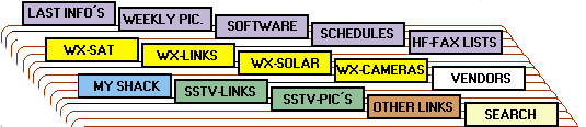
 Note: this clickable Graphic works only with Netscape/MS IE 2.0 or higher!
[Home |
Last Info´s |
Weekly Picture |
Software |
Schedules |
HF-FAX Listings |
Weather Satellites |
Weather Links ]
[Solar Weather |
|Weather Cameras |
My Shack |
SSTV Links |
Vendors |
SSTV Pictures |
Other Links |
Search Tools ]
Note: this clickable Graphic works only with Netscape/MS IE 2.0 or higher!
[Home |
Last Info´s |
Weekly Picture |
Software |
Schedules |
HF-FAX Listings |
Weather Satellites |
Weather Links ]
[Solar Weather |
|Weather Cameras |
My Shack |
SSTV Links |
Vendors |
SSTV Pictures |
Other Links |
Search Tools ]
Weekly Facsimile Picture (changed every weekend)
 = Updated Sep-19-1999
Map Graphics Reference Chart
I would like to show on this page radiofacsimile pictures from overseas stations. If you are able to receive a good picture, please send it to me and I will place it here.
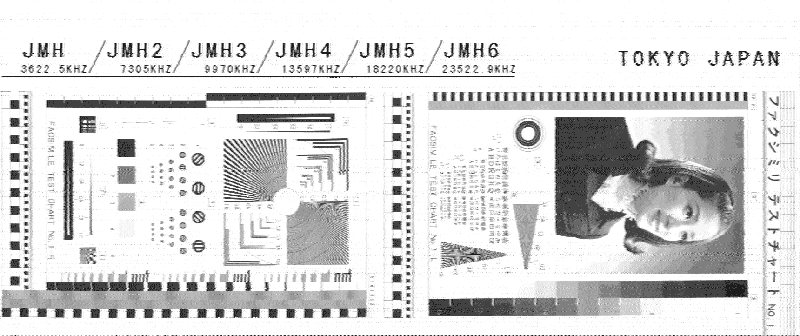
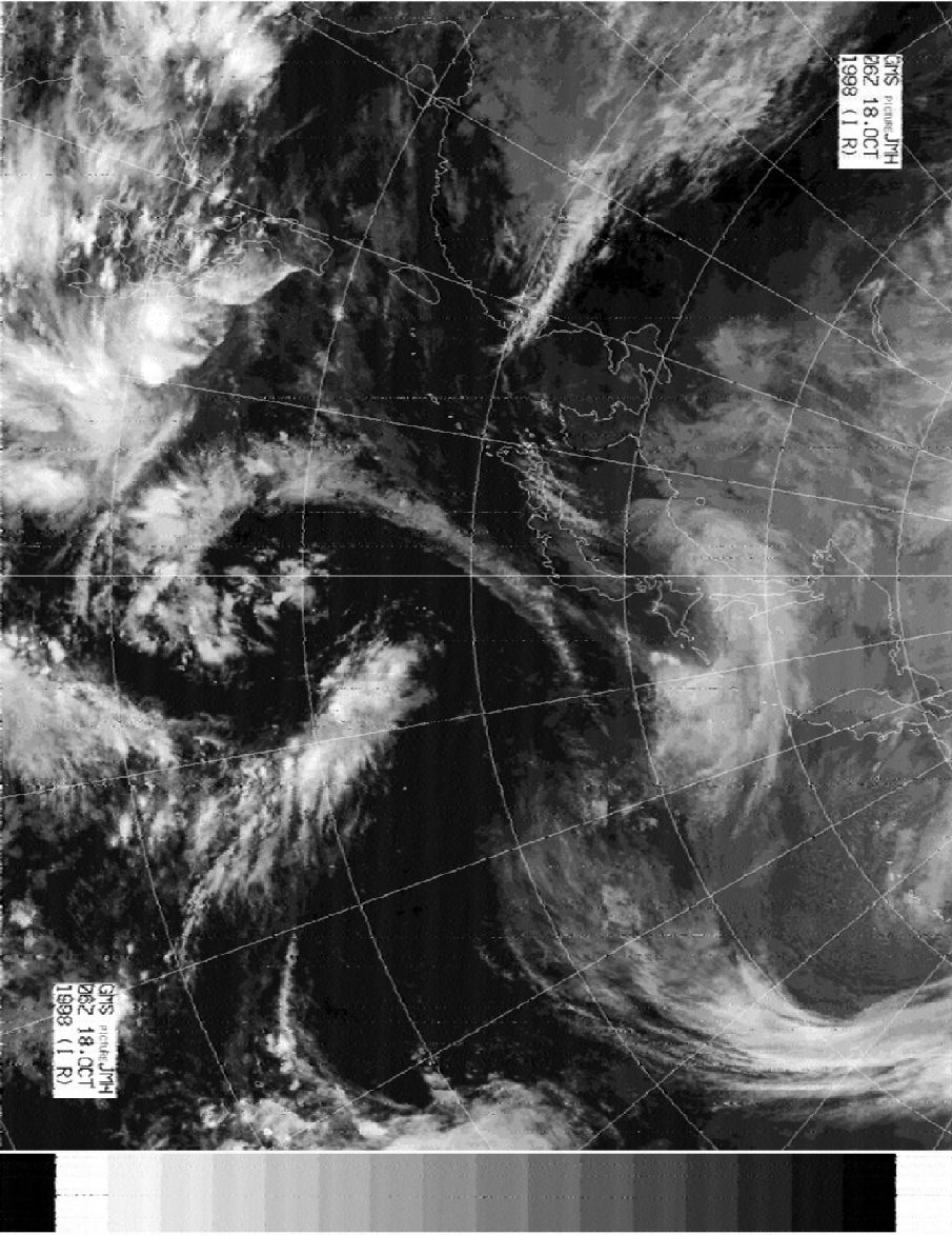
Facsimile test chart from Tokyo Meteo (JMH), Japan received in Hannover, Germany on 18220 kHz
Visit also my MIR SSTV Picture Gallery, with pictures from different sources.
My first Pictures from OKEAN-0
OKEAN-0 now active, and I received since 18 September my first pictures. OKEAN-0 transmit on 137.400 MHz with a much stronger signal as OKEAN 1-7.
The 08:29 UTC pass on Sep. 18 you can see some anomaly on the left side, it seems to be a visible picture only.
The 07:22 UTC pass on Sep. 19 has a max. elevation of 8.4. The picture shows Russia down to the Black See.
The 08:58 UTC pass on Sep. 20 shows a detailed picture from south Scandinavia and north Denmark.
OKEAN-0 18 September 08:29 UTC
OKEAN-0 19 September 07:22 UTC
OKEAN-0 19 September 08:58 UTC
Receiving Wefax photos on Shortwave
The reception of meteorological satellites has become a more child´s play last years.
Due to digital hard and software technology puts real-time satellite images on your PC monitor.
Inexpensive software such as WXSat or JVComm connect to a Wefax receiver allows you to decode Geostationariy and Polar Orbiter Satellites.
For more then 10 years it was very expensive to receive "live" such images, but for Mariners, Meteorologists, Pilots and Yachtmens, the consultation of Satellite pictures was a daily routine.
These users used the Long and Shortwave transmissions to receive Satellite pictures.
Due to propagation and fading signals on the shortwave bands they use Frequency Modulated (FM) transmissions instead of Amplitude Modulation (AM) transmissions from the Satellites.
The drum speed in use on shortwave is 120 (lines scanned per minute) and the index of cooperation (IOC) in use is 576.
A standard document with a lenght of 495 mm and a drum diameter of 152 mm needs 18,8 minutes.
In the past you could receive daily hundrets of Satellite "retransmissions" worldwide, but due to modern satellite technologies more and more stations ending the services on short and longwave to change to the new satellite technologies.
Due to the propagation on the shortwave bands it is possible to receive all stations from any location worldwide.
At the moment we go to the maximum of the "11 year solar cycle" wich means you have excellent signals over very long distances.
Radiofax stations transmitting most of the time weather charts who are the best way to inteprete the satellite images such as forecasts and tracking of hhurrican/typhoon weatherforcasting in this area.
At the moment ther are 7 Radiofax stations around the globe who transmit daily on the shortwave bands Satellite "retransmissions" from the stations area.
Frequencies and schedules are also available on the HF-FAX pages (see HF-FAX listings and Schedules).
Take a look at the Satellite pictures received on shortwave at my location Hannover, Germany.
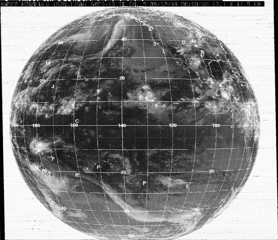
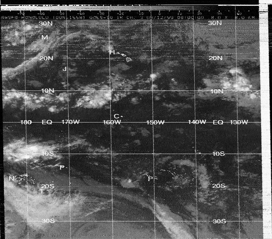
Honolulu Meteo (GOES-10 IR CH0 central Pacific area) and (GOES-10 IR CH3 Hawaii area)
Tokyo Meteo (GMS IR west Pacific area)
Taipei Meteo (GMS IR Taiwan area)
USCG San Francisco (GOES-10 IR east Pacific area )
USCG Boston (GOES IR NW Atlantic / USA)
USCG New Orleans GOES IR Gulf of Mexico)
Delhi Meteo (INSAT) not available
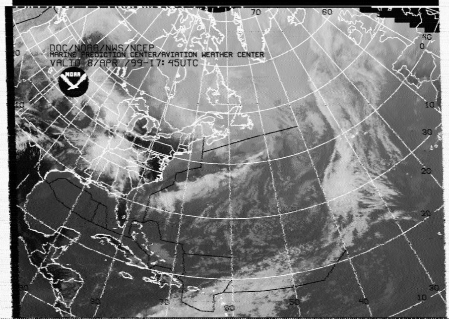
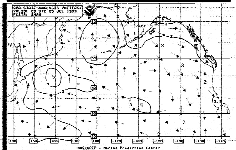
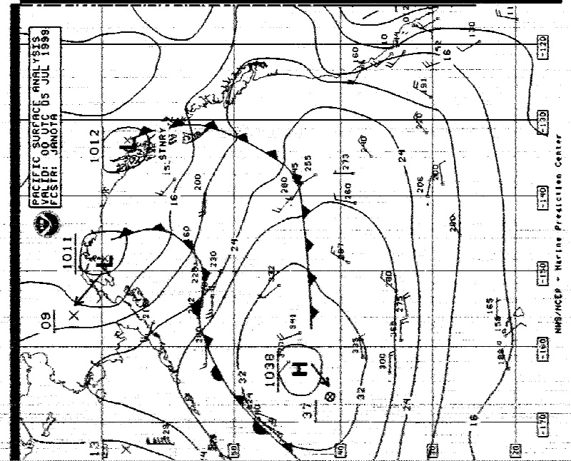
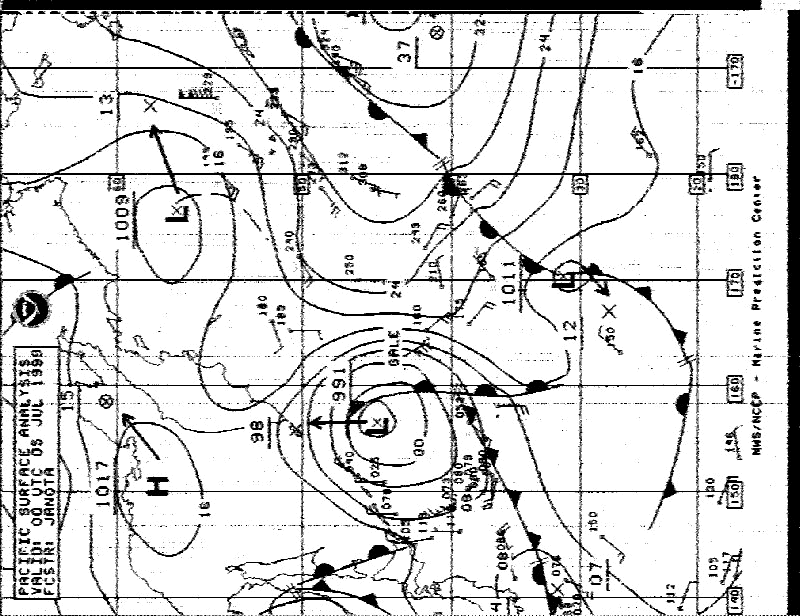
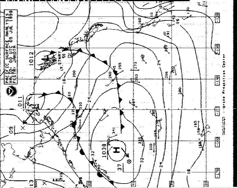
USCG San Francisco (NMC) Pt. Reyes, California, USA is one of the Coast Guard stations who transmit daily a lot of usefull charts for the ships on the high seas.
Normally it is very hard to receive good signals here in europe from the US westcoast, but due to the good propagation conditions we have sometimes
clear signals at night on 17151.2 KHz from PT. Reyes.
Download some charts from USCG San Francisco received here on my location in Hannover, Germany.
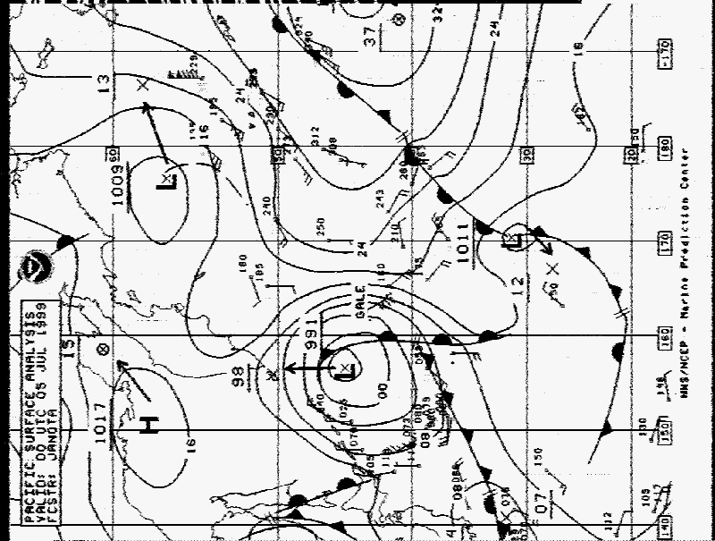
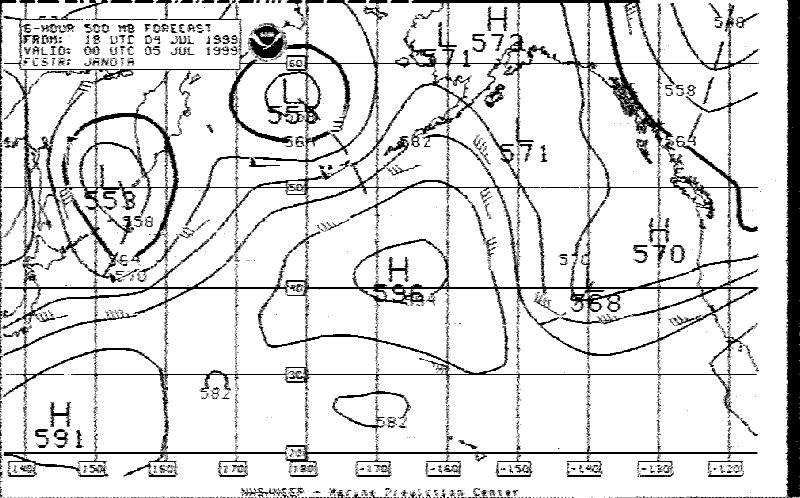
02:59 UTC Satellite image
03:10 UTC Sea state analysis
03:20 UTC Surface analysis (Part 1 NE Pacific)
03:33 UTC Surface analysis (Part 2 NE Pacific)
03:45 UTC Rebroadcast of 03:20 UTC
03:58 UTC Rebroadcast of 03:33 UTC
04:10 UTC 500MB analysis
Kyodo News Service, Japan has also a Radio Fax Service (Tokyo Radio JJC) for owners of ships wich are going around the sea. Some go far down to the Atlantic Ocean.
For those ships , there is a re-transmit via the Singapore station.
Since 1993 some transmissions are also scrambled, so only persons who install an decoder can receive these Radio Fax Broadcasts.
Tokyo Radio (JJC) facsimile news services are morning paper, evening paper, weather forecast, navigation cautions, for instance a schedule of rocket tests, ocean temperature charts, sports, etc.
Download some broadcasts received sunday Jun 20 on 22.542 KHz between 07:45 and 11:20 UTC here on my location in Northern Germany:
07:45 UTC Kyodo News sunday edition
08:13 UTC Maritim safety information MSI/GMDSS
08:26 UTC FAX JSU News
08:50 UTC Shipping information
10:00 UTC Scrambled transmission
11:00 UTC NX Navigational warnings
NOAA 14 pictures captured with WXSAT and boundaries added with TRACKER.
NOAA 14 1301 UTC 16 May 13:01 - 13:17 UTC
NOAA 14 1443 UTC 16 May 14:43 - 14:57 UTC
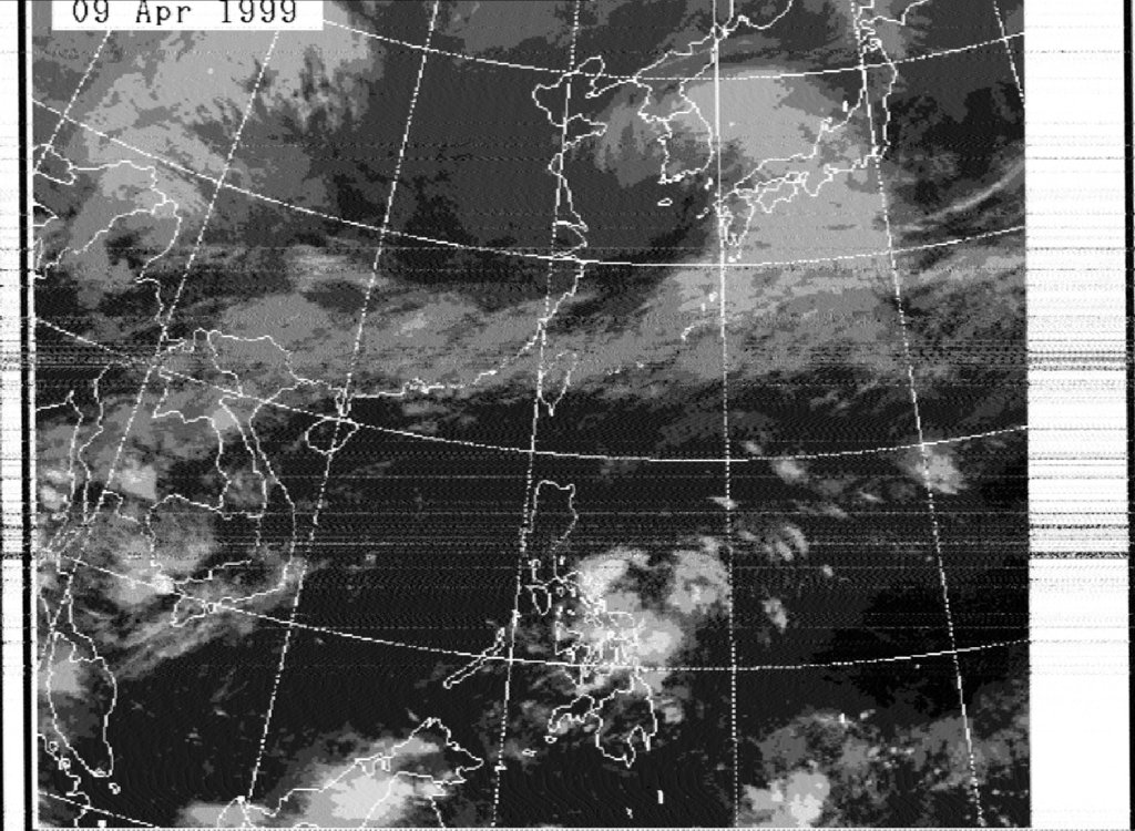
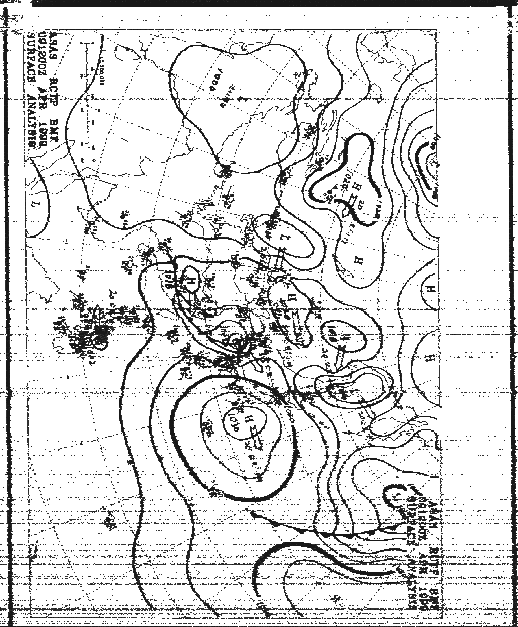
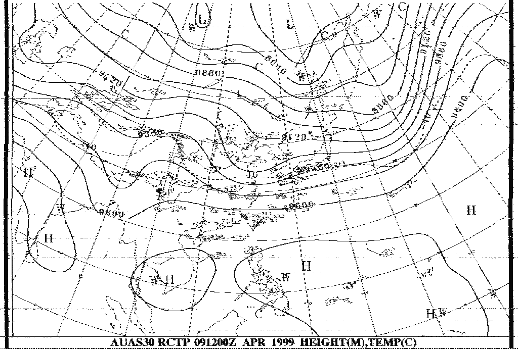
Taipei Meteo (BMF) transmit daily on four frequencies 4616, 5250, 8140, 13900 and 18560 KHz a lot of usefull marine charts for the high seas for this area.
Download some maps wich I received here in Hannover, Germany.
ASAS Surface Analysis with plotted Data
AUAS30 Height Temp Analysis
GMS Satellite Picture
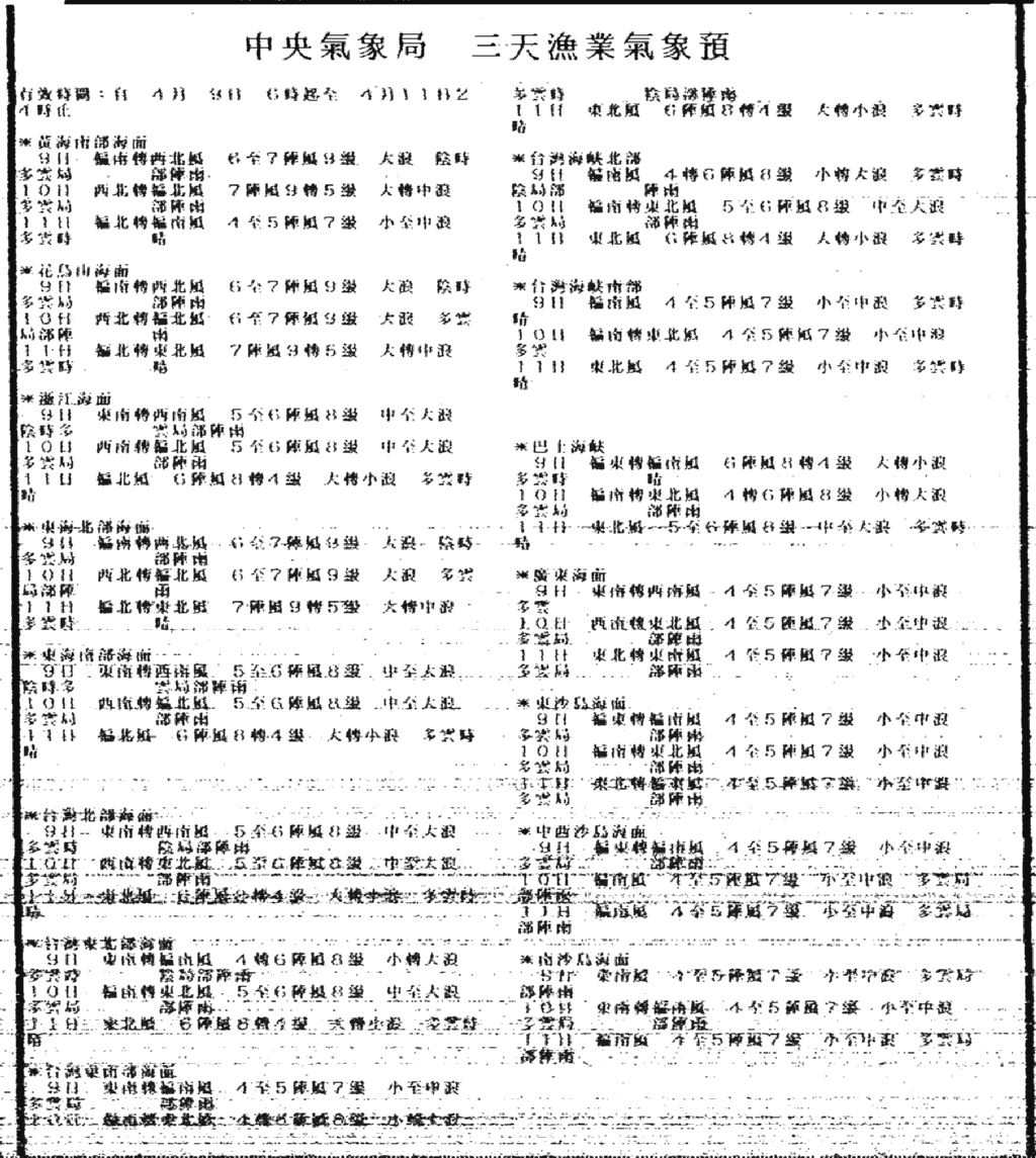
Plain Text Fishery Weather Forecast (Chinese Text)
FUWX854 48H 850MB Equatorial Belt Wind Prognosis
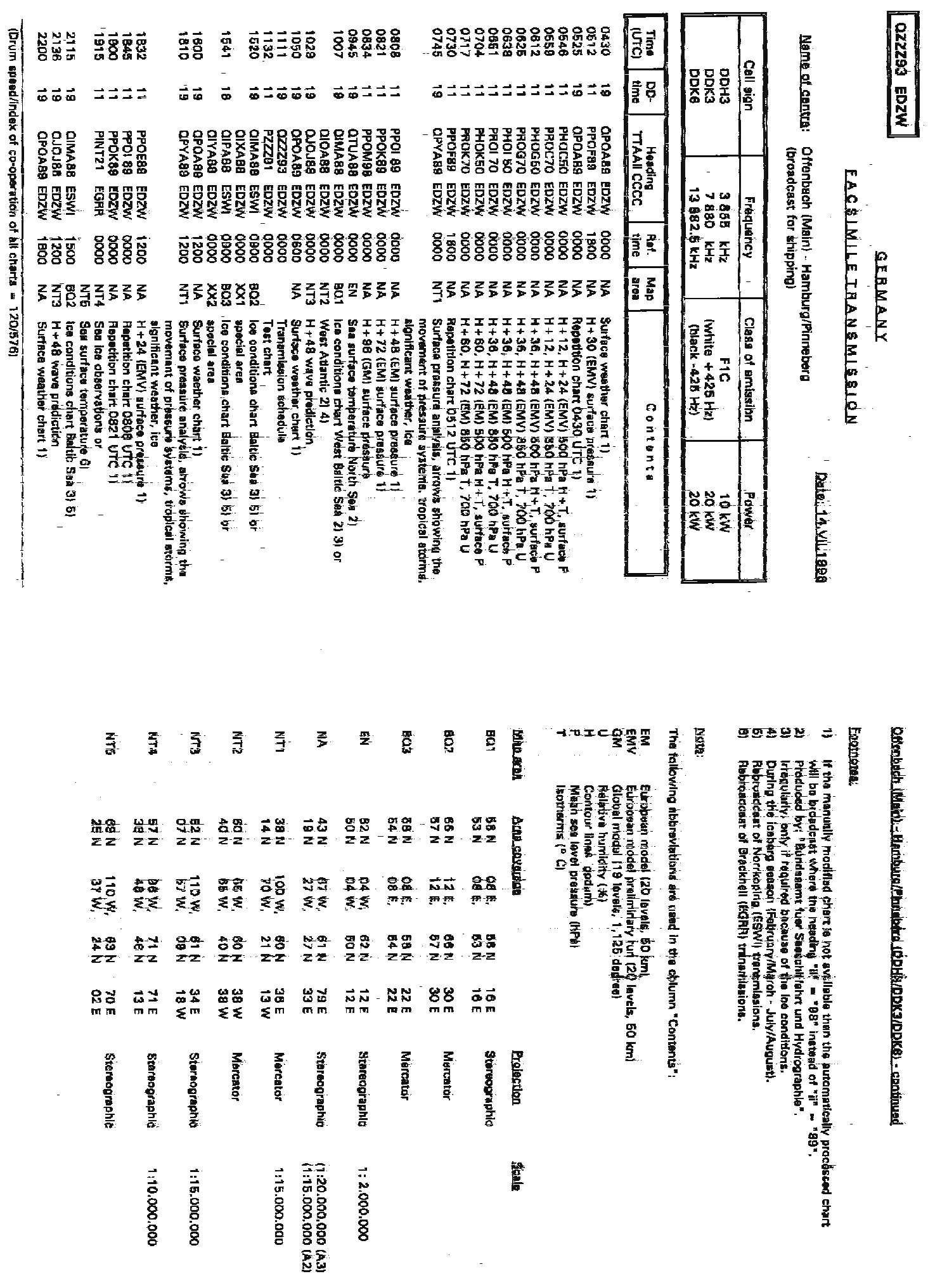
Hamburg Meteo, (TX site Pinnenberg) is one of the European Fax Stations who transmit daily charts for the maritim users.
My location Hannover is about 80 KM south of Pinneberg, so I have a loud signal but very often problems with Multipath signals.
Download some charts received on 3855 KHz (DDH3) at Monday 05 April.
Transmission schedule 11:11 UTC Due to the very small letters, it is very hard to receive a readable schedule.
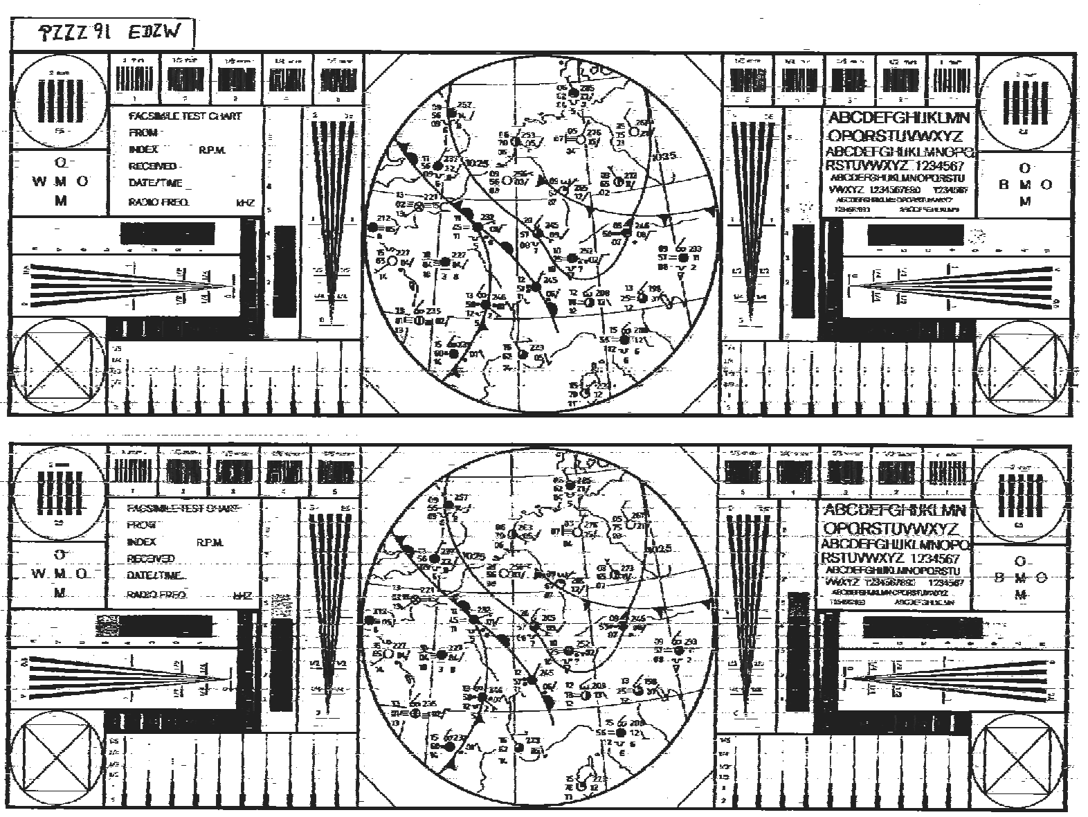
WMO Test chart 11:32 UTC Transmission not as greyscale, only B&W !
H+96 Surface pressure prognosis 08:34 UTC
H+48 Sea wave predictions North Atlantic 10:29 UTC
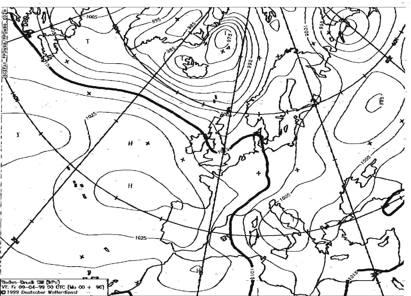
Surface weather chart with plotted data North Atlantic 10:50 UTC
The Dissemination schedule for Meteosat 7 was changed 01.04.99, and has a replacement of GOMS by ITOT a full Disc IR INDOEX (Indian Ocean) from Meteosat 5.
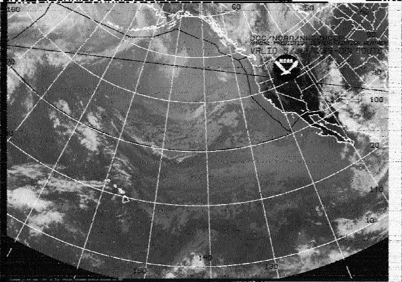
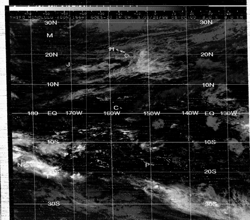
Honolulu Meteo (KVM) is one of the DX Stations here in Europe. The distance between Honolulu and Hannover, Germany is 11738 KM.
The Propagation around 0600 UTC at this time of the year is fair, to receive readable charts/maps.
GOES 10 IR Channel from Honolulu Meteo on 11090 KHz, 21 Mar 99 at 06:45 UTC received in Hannover, Germany
Hellschreiber, wich becomes worldwide a renewed interest is a very old mode wich was first introduced 1921 by Rudolf Hell.
The Hellschreiber is an early faximile communication, where only upper case letters were transmitted and received.
Hellschreiber is an asynchronous transfer mode where the signal is discretely coded. This means two things:
The transmitter does not tell the receiver how fast it transmits. It simply sends the message in it's own speed and the receiver must do it's best.
Hellschript is transmitted with either on or off signal. It was hence easy to implement on available radio equipement. One simply connected the transmitter to where the morse key
would be. Such signals are very sturdy to radio noise. All unwanted frequencies may be filtered away.
The hellschreiber was invented by Dr. Rudolf Hell in 1929. It was used by the Germans during WW2 and some receivers was built by the British and Americans to intercept enemy
communications.
 Nino Porcino, IZ8BLY in QSQ with Vilnes, YL2KF on 14063.5 KHz (LSB) Mode Feld Hell
Nino Porcino, IZ8BLY has make a excellent Windows 95/NT based Hell program wich used the Sound Card from your PC.
You can download the program from Nino´s Home Page
For more info on Hellschreiber you should first check Murray´s ZL1BPU Pages wich is the best source on the net.
You can find Hellschreiber transmissions during weekends at 14063.5 KHz LSB (13:00 UTC mode Feldhell), also on 7037 KHz and 3580 KHz LSB (Tuesdays 20:00 UTC) for Europe.
Check also 3560 KHz LSB at 08:00-09:30 UTC for the "Hellraisers" Net or the DX Hell frequencies at 10140, 14063.5 or 21063.5 KHz LSB between 05:00 and 10:00 UTC.
Feld Hell Picture received on Saturday 07 March 1300 UTC on 14063.5 KHz LSB
Download a picture I have received from Met 2-21, this bird is also operative since last week (Met 3-5 was off).
Meteor 2-21, 06 Jun (B&W)[MET21.JPG - MISSING] afternoon pass with excellent cloud features.
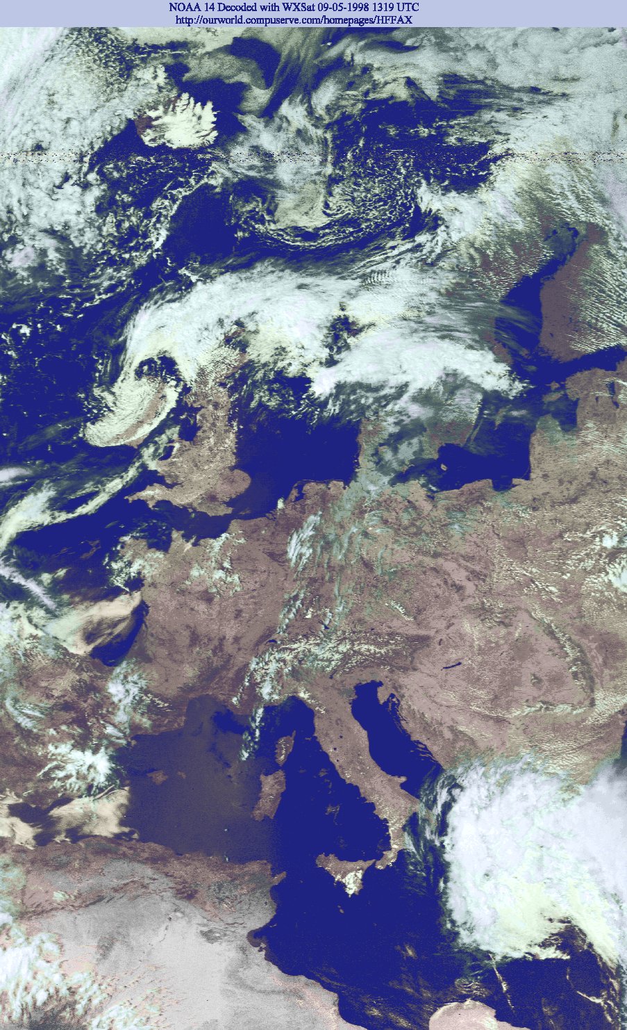
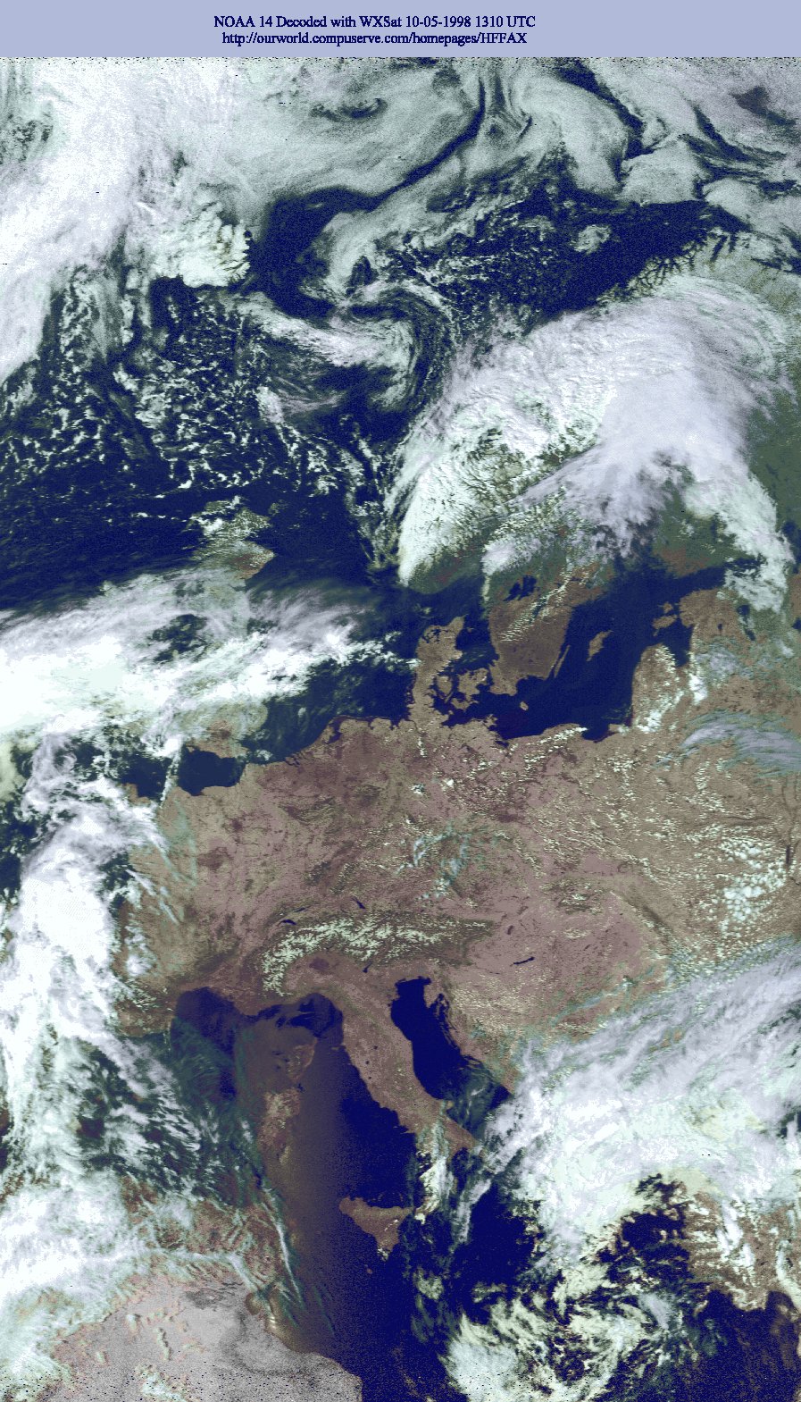
Central Europe is cloud-free and we have summery weather now. I have uploaded two NOAA 14 Images received 09 & 10 May.
The APT Satellite pictures are decoded with WXSat and with a good resolution (> 400K), so you can print them also as a color picture on Glossy paper/film.
- NOAA 14, 09 May midday pas with excellent details from Africa to Island
- NOAA 14, 10 May midday pas from Africa to Island, but on this picture UK/Spain with more clouds.
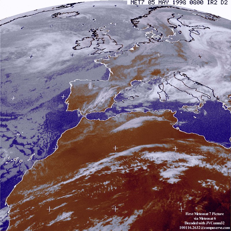
On May 05 1998 I have received the first APT Image from Meteosat 7, it was disseminated via Meteosat 6 channel 1 at 0823 UTC.
I have decoded this Image with JVComm32 and EasyDSP
There are only two Press Photofaxstations on the air. These are KCNA Pyongyang and VNA Vietnam.
Download a Press Photo from VNA Vietnam, send to me by Mohammad Sultan, Mauritius.
Mohammed Sultan from Mauritus found a new Faxstation from Argentina. He has received Jun 28 1997 between 0230 and 0300 UTC on 5705 kHz (USB) maps from the Argentinian Navy at Puerto Belgrano (LOR). The station using JVFAX 7.0 (see upper left corner) and put the callsign LOR at the upper right corner.
Download the LOR map here lor.jpg (296K)
 Okean 4
(called also Okean 1-7) provide radar, microwave and optical images for sea navigation and ice situation in the Arctic, Antarctic and northern seas. The received APT images on 137.4 Mhz have mostly a visible light image, a low resolution microwave scanner image and a radar image.
Okean 4
Okean 4
(called also Okean 1-7) provide radar, microwave and optical images for sea navigation and ice situation in the Arctic, Antarctic and northern seas. The received APT images on 137.4 Mhz have mostly a visible light image, a low resolution microwave scanner image and a radar image.
Here is one of the few scheduled Okean pictures (208K) from week 4-11 May, received at May 7 1997 0429-0436 UTC, from this passes I could only receive Okean from 0432-0436 UTC, so I missed the first 3 minutes.
Equipment:
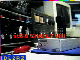
Weather Satellite Receiver: Wraase MR-9202 *.
Antenna: RF Sytems WSA-137 active antenna.
Software: JVFAX and WXSat.
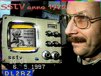
* = Volker Wraase DL2RZ is one of the SSTV pioneers (Wraase modes), here are two SSTV pictures wich I received 08 May on 3730 kHz, Mode Martin 1:
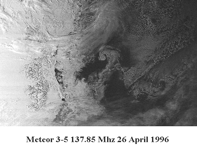
 Meteor 3-05
 one of the "long live" Russian weather satellites transmitting daytime visible APT images, the infra-red sensors ceased activity end 1993.
Meteor 3-05
Meteor 3-05 one of the "long live" Russian weather satellites transmitting daytime visible APT images, the infra-red sensors ceased activity end 1993.
Meteor 3-05 orbit 1200 km above the earth, so it has a greater range than the NOAA satellites (800 km). Some passes are up to 20 minutes.
The images shows the cloud, snow and ice cover excellent, but land details are very poor.
Here is a small detail from one of the 26 April passes from the mid Atlantic to the North pole, it shows the east cost of Greenland.
Meteor 3-5 East coast Greenland (105K). This image was decoded with WXSat
Equipment:
Weather Satellite Receiver: Wraase MR-9202*
Antenna: RF Sytems WSA-137 active antenna.
Software: JVFAX and WXSat.
* = Volker Wraase DL2RZ is one of the SSTV pioneers (Wraase modes), here are two SSTV pictures wich I received 08 May on 3730 kHz, Mode Martin 1:
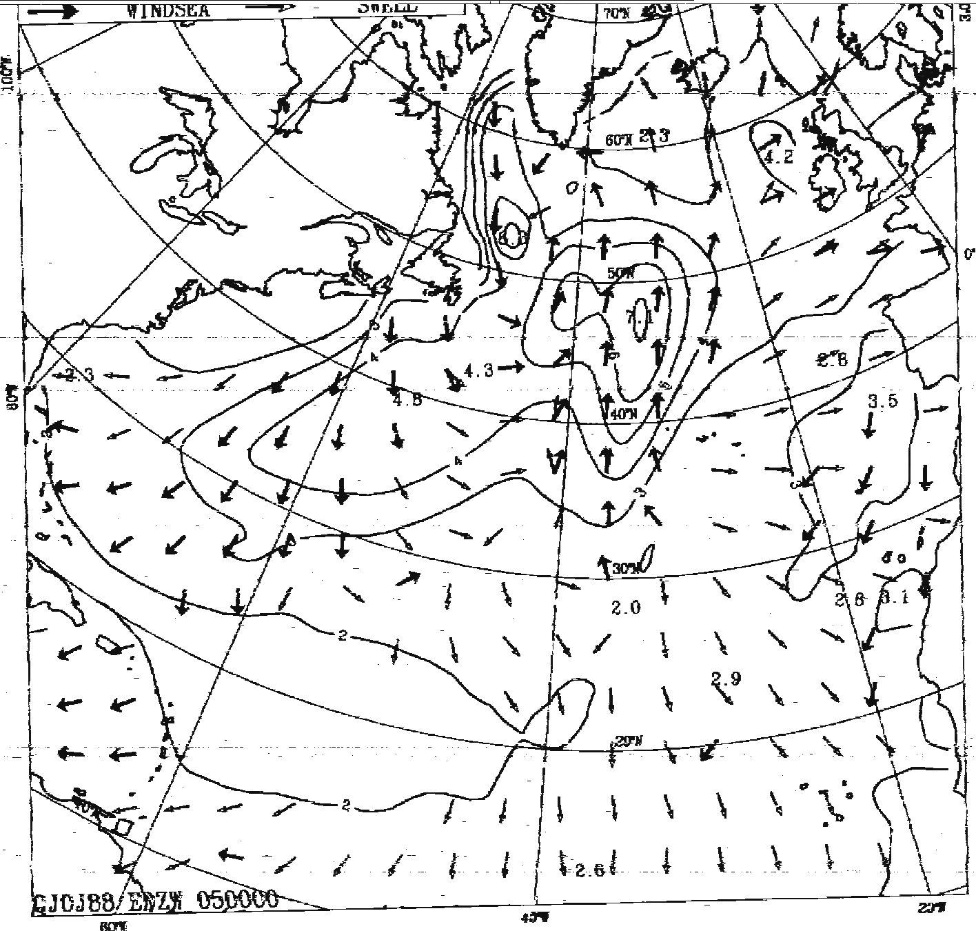
Download some up-to-date facsimile pictures from the orginated stations Bracknell, Tokyo, Melbourne, Auckland and Buenos Aires Meteo.
Bracknell Meteo
Sea Level Isopleths & 1000-500 MB Thickness [48 HR][72 HR] FCST Europe & North Atlantic (Polar Stereographic)
Sea Level Isopeths & 1000-500 MB Thickness [96 HR][120 HR] FCST Europe & North Atlantic(Polar Stereographic)
Mean Sea Isotherm Chart 5 Day Analysis, North East Atlantic & North Sea
Upper Wind and Temperature Chart 18 HR FCST Europe & Extreme North Atlantic FL 390
Upper Wind and Temperature Chart 18 HR FCST Europe & Extreme North Atlantic FL 180
Sea Swell/Wind Direction Chart 12 HR FCST North Atlantic & Caribbean Sea
Sea Swell/Wind Direction Chart 48 HR FCST North Atlantic
Sea Swell/Wind Direction Chart 24 HR FCST North Atlantic
Sea Swell/Wind Direction Chart 00 HR FCST North Atlantic
Tokyo Meteo
00Z SIGWX FL250-450 for 0-70N,170W-100E
12Z SIGWX FL250-450 for 0-70N,170W-100E
Melbourne/Auckland Meteo
12Z SIGWX for 50N-50S,180-100E
18Z SIGWX for 0-50S,140W-140E
00Z SIGWX for 00-50S,180-100E
Buenos Aires Meteo
12/24Z SIGWX FL100-250 for Southern South America
12/24Z SIGWX FL250-450 for Southern South America
Back to the Homepage